Seeing through the clouds in Central America with Copernicus satellites

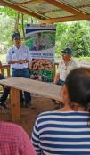
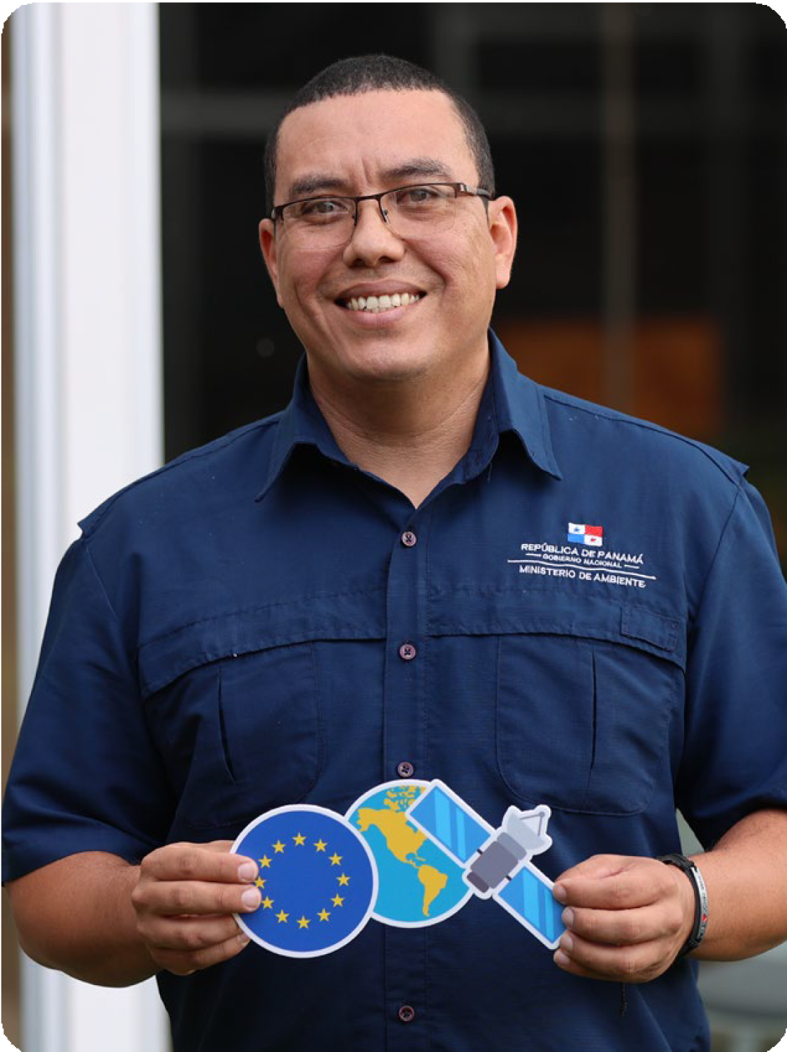
Nivardo Ibarra is excited to return to Panama with a new skill. He recently learned how to create radar satellite images using the European Union's Copernicus programme's Earth observation technology.
Ibarra works for the Ministry of the Environment of Panama where cloud cover is an eternal challenge in environmental monitoring. He was one of the 35 Central American professionals from a range of sectors who attended the Copernicus AFOLU (Agroforestry and Other Land Uses) Cluster Course in San José, Costa Rica, last May.
European Union
Game-changing potential
With Copernicus satellite data, Ibarra can monitor areas which would otherwise go unobserved. This has the potential to be a game-changer for environmental managers. ‘These images are essential for the work we do because they allow us to see behind the clouds,’ he says.
Copernicus training does not just apply in agroforestry and land-use scenarios like Ibarra’s case. In the near future, the EU will provide three more specialist Copernicus training courses around the following topics:
- The Marine and Oceans Cluster for topics like dealing with the Sargassum seaweed crisis, maritime monitoring, illegal fishing, and reef biology.
- The Hydrographic Basins and Water Resources Cluster will focus on comprehensive basin management, vegetation, navigation, climate and emergencies. Water management data from satellites is used to anticipate droughts and floods.
- The Cluster on Urban Planning for developing green and smart cities, developing marginal areas and risk management.
These training programmes are organised by Copernicus LAC. In the future they will work closely with the two regional centres in Chile and Panama, set up in the context of the Global Gateway Investment Agenda for the region. Their mission is to transfer skills, expertise and EU space-related digital services to LAC countries and demonstrate potential of Copernicus satellite imagery for the region. The Copernicus Panamá centre will host the 1st face-to-face training in the week of 8 July about “introduction to satellite data and digital tools for Earth Observation”, with participants from 9 countries.
Copernicus foresight
The Central American region is particularly vulnerable to the impacts of environmental extremes and climate change. Drought, heat, wildfires, extreme rainfall and severe hurricanes have major impacts on health, food & energy security and economic development.
Copernicus satellite images and data analysis can help to address those challenges and support solutions for the agriculture, forestry, oceans, and watersheds/water resources in the region.
The Central American Dry Corridor is a strip of land across Guatemala, Honduras, El Salvador, Nicaragua and Costa Rica which is vulnerable to drought and climate change extremes. Here, Copernicus data is used to measure soil moisture, threats from fire, high temperatures and flooding. Copernicus is used to monitor crops that may be affected by climate phenomena in these territories where the most acute problems of food security occur in the region.
European Union
Pictured: Map of Central American Dry Corridor, January 2024 during the rainy season
Copernicus
Pictured: Map of Central American Dry Corridor, April 2024 during the dry season.
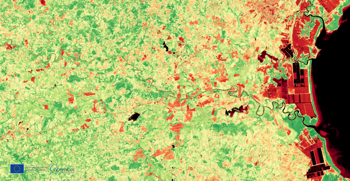
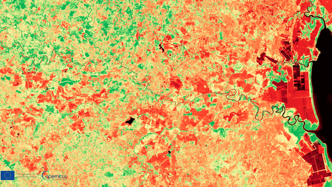
Comparing satellite images
The images below show the vegetation indices of the Santa María River in Panama at two different times. The first image was taken after the rainy season on 22 January 2024. The second image is of the same vegetation as seen during the dry season on 16 April 2024. Comparing images like this and years’ worth of data can be used to analyse the impact of phenomena like El Niño and La Niña in increasing droughts and floods.
Deforestation in Central America has increased, particularly in those areas with large reserves of natural forest cover and where a large part of the region's rich bio-diversity is concentrated. The main causes of this accelerated deforestation are cattle ranching, large-scale agro-industrial crops, agricultural burning and forest fires. Data provided from Sentinel-1 and Sentinel-2 Earth observation satellites are used to map vegetation cover in the region for improved forest management.
The Copernicus Marine Service provides free, open data about marine life to use in policy and scientific research. It uses satellite images as well as data from in situ sensors, to measure water pH levels, ocean currents & temperatures as well as biomass and other indicators.
In the areas where the water temperature is higher, there is a greater risk of extreme climate events such as hurricanes, which are mainly concentrated in the tropics.
Copernicus also monitors the growth and trajectory of Sargassum seaweed crisis. A large brown algae, Sargassum floats in large masses which sometimes stretch for miles. Due to ocean pollution, it is now over-abundant and invasive. Excessive seaweed blooms create problems for fishing, shipping and tourism in coastal communities. Information from satellites is used to prevent and respond to the rapid spread of the species in Central American Caribbean in particular.
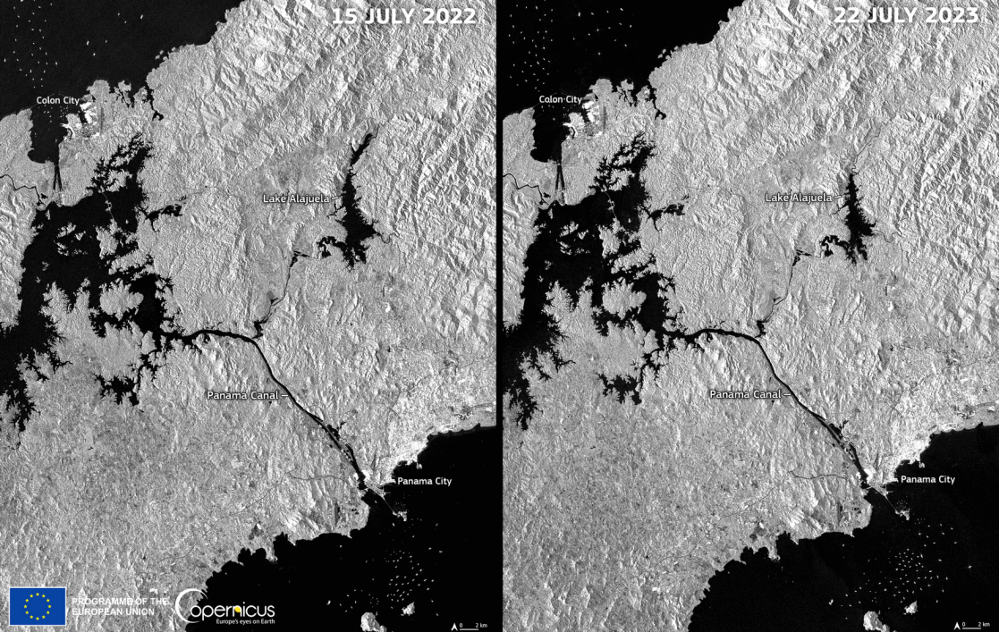
While monitoring water resources, one of the Copernicus Sentinel 2 satellites captured images of Lake Alajuela, which feeds the Panama Canal, losing a large amount of its water reserves over the course of a year. This impacted everything from the navigation of ships through the canal and had negative effects on the communities that depend on this ecosystem.
European Union
Pictured: Before/after radar satellite images of Lake Alajuela, Panama.
Copernicus is a very useful tool for land-use planning in urban areas. It is used to help monitor and to improve precarious urban settlements. Urban planners use data from Copernicus for planning mobility, green areas, water sources, public infrastructure and many other elements of urban design. This capacity is very relevant in Central America, where 70% of the population is concentrated in large cities.
About the EU - LAC Digital Alliance
The EU-LAC Digital Alliance is a partnership between the EU and Latin America & the Caribbean, focused on digital cooperation in areas such as space & satellite data, secure connectivity, artificial intelligence and innovation.
The Digital Alliance is based on a shared belief in an inclusive, secure and human-centric digital transformation for sustainable development.
Launched in Bogotá (Colombia) in March 2023 and supported by the EU’s Global Gateway, the EU-LAC Digital Alliance is considered a model of cross-regional digital cooperation. It has already begun to deliver on a digital transformation that leaves no one behind.
Cooperation on space and satellite data is one of the pillars of the Digital Alliance.
- For more information, follow the link to download the EU-LAC Digital Alliance Factsheet.
PLUS DE RÉCITS